
- Home
- Driving to Shusha – a Personal Experience
Driving to Shusha – a Personal Experience
November 8 is "Victory Day" in Azerbaijan, commemorating the day Azerbaijani forces retook the city of Shusha during the 2nd Karabakh War. In this article, Mark Elliott takes us with him to see what's along the road to Shusha.
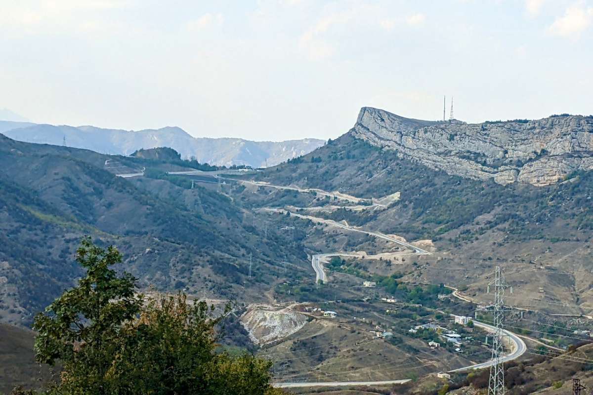
Image: Mark Elliott
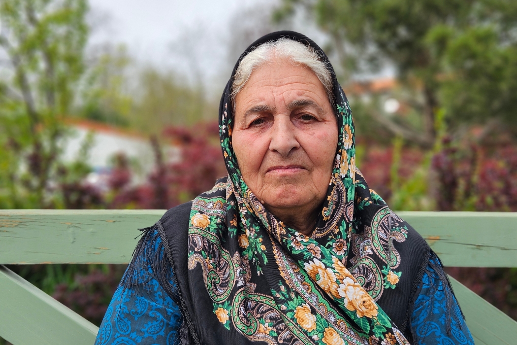
It was exactly two years ago today – November 8, 2020 - that Azerbaijan regained control of Shusha in a daring attack that will doubtless one day be the subject of movies. The city’s importance in strategic and emotional terms is such that November 8 is the date celebrated in Azerbaijan as ‘Victory Day,’ though the tripartite agreement that ended the conflict was signed a day later. However, the Shusha that was de-occupied was little more than a collection of ruins, as the Caspian Post illustrated in Orxan Azim’s fascinating photographic portrait, Snapshot of Shusha. In January, once bus tours from Baku started taking the families of former residents on gruellingly long day trips, we interviewed one of the first civilian visitors. He was taken aback by the degree to which the city had been left in a ruinous state after three decades of occupation. Since then, there have been a plethora of festivals and cultural events held in Shusha, but getting permission to visit remains complicated, especially for foreigners. When I was offered a rare opportunity to go, I jumped at the chance to see how one reaches the fabled city with my own eyes. So, this article focuses not on Shusha itself but on the fascinating journey to get there.

Road signs at Alat already indicate Shusha. Image: Mark Elliott
As if to emphasize the city’s importance to the national psyche, the name Şuşa (Shusha) starts appearing on signboards less than an hour south of Baku when the place is still over 300km away. The fastest route takes the Astara-bound highway as far as Salyan, cuts west, bypassing Bilesuvar then roughly parallels the Iranian border to a small bazaar settlement called Mahmudlu/Ahmedbeyli. From here, the ‘Victory Road’ (Zəfər Yolu) to Shusha starts off through vivid green alfalfa fields and passes typical villages like Kurdmahmudlu made maudlin by repeated poster boards remembering fallen soldiers. After just over 20km, the scene starts to change. Agriculture stops. There’s an old sniper post north of the road. Then a police check post where matter of fact officers photograph IDs and check them for permission registration. The procedure is swift, and I’m surprised by the steady trickle of traffic on what I had expected to be a much quieter road.
Into the De-occupied Area

Image: A.Aida88/Wikimedia Commons
The skeletons of destroyed old stone homes have begun. There’s a sign in Azerbaijani to announce that the road has entered the formerly occupied area, and another warns of land mines and unexploded ordinance. A curious network of wires is apparent beside the road – former wine-growing equipment that had been refashioned pre-2020 into an anti-infantry trap. Just beyond, near Km 24/77, we stop to look at a roadside mound, topped with a commemorative rock installed to remember the Azerbaijanis who died here in September 2020: they were amongst the first casualties of the Second Karabakh War. Climbing the mound, it becomes rapidly apparent that this outwardly featureless hillock was, in fact, a carefully constructed warren of Armenian bunkers and trenches. Other than erecting the memorial stone, the site has been left consciously untouched, giving a shockingly visceral impression of the miserable realities of war – from rusty tin cans dumped everywhere by the former defenders, to dropped helmets, ammunition boxes and the odd military jacket strewn about the foxholes. It’s a searingly direct reminder of the battles that raged here so very recently.

One of the first posts of the Armenian occupation forces to have been overrun in the 2020 war. Image: Mark Elliott
The road continues through fields with a series of trenches suggesting further signs of battle defences. Then, ghost villages appear one after another – the stone remnants of homes, often barely waist high. The road cuts between what had been Qaraxanbeyli and Merdinli, neither with a single building standing. I’ve seen many a video of displaced Azerbaijanis returning to seek out their former homes after 30 years and finding such massacred places worse than their nightmares. I somehow thought I’d be prepared, but the reality was overwhelming. The sheer extent of the desolation is beyond description.
Fizuli
Fleetingly visible, the sleek lines of Fizuli International Airport offer brief respite at Km 33/68, and a large encouragingly neutral sign wishes arriving passengers ‘Welcome to Karabakh.’

A little further, hard-hatted men, trucks and cranes are beavering away at building new roads and a sizeable new town area. However, across the road from the latter lie the remnants of central Fizuli. Once a city of 17,000 people, it’s now a wasteland. An overgrown tangle, more of those stone skeleton houses mixed with piles of rubble where homes once stood.

Fizuli – remains of a fine building that had been used as both a theatre and as the offices of the Araz Publishing House. Image: Mark Elliott
A kind of makeshift square by the roadside allows visitors to stand and survey the scene, which is given a little definition by the two-storey shard of a once ornate neo-classical arch, once a theatre. Such is the greenery and the grandeur of the distant mountain backdrop that the ruins here seem somehow less horrific than the smaller settlements we passed earlier – or am I just getting used to the destruction?
Towards Tugh
After another 10km or so, the mountains are drawing closer, and the scene becomes rapidly more attractive. But before the road starts to incline, we stop briefly to spy a small building high on the top of a steep, bald hill that rises abruptly to the north. This appears to be an ancient Christian chapel and is also considered a ‘pir’ (sacred place) by local Muslims who call the little mountain Mengelen Ata. A little further, hazelnut saplings of a future orchard had been planted and in surrounding fields - vineyards where Karabagh’s archetypal Khindogni (aka Khndoghni) grapes are grown. With firm blue-black skins and sweet yet tart flesh, their flavour is intense and floral. I’d love to try the wine.

Picking grapes south of Tugh. Image: Mark Elliott
For now, the grapes picked here are shipped to the industrial winery in Aghsu – 50 tonnes of them last year. A limited batch of rosé wine made from them can be sampled at the Kefli Wine Bar in Baku. Meanwhile, the Tugh winery essentially survived the war intact and is currently mothballed pending new management. Inside, aging barrels signed by wine tourists in various languages await new wines. The inox distillation vessels look ready to use, though the bottling machinery has been removed.

The Tugh winery in 2022, Soviet era Hadrut wine labels, barrels signed by well-wishers. Image: Mark Elliott
The rest of pretty little Tugh village[1] looks a little the worse for wear with holes in roofs and some collapsing timbers, though nowhere near as desolate as the lowland ruins around Fizuli. Indeed, the somewhat ragged state of the WWII memorial and the tumbledown former palace (used as a local school building until 1978) doesn’t look much different from those apparent in pre-2020 photos. Tugh village retains plenty of tourism potential and has fine views back to the west.

The building, originally built for 18th century local lord ‘Melik,’ looks much the same today as it did when this photo was taken in 2019. Image: Gardmanahay/Wikipedia
Salvageable older houses sit in tree-shaded gardens, climbing a hillside towards a seemingly well-preserved church and the backdrop of a towering granite cliff. For now, however, most of the settlement is out of bounds behind a police barrier to protect the property while the place remains unpopulated.
Hadrut & Azikh
From Tugh, we made a couple of diversions. Highlights of the smoothly paved road southwest to Hadrut are views from the hairpins on either side of a high pass that cuts through steep forested slopes. The most appealing panorama looks back towards Tugh and Ataqut, its baby twin village across the valley, with the powerful cliffs of Tughdagh rising behind.

Overlooking Hadrut. Image: Mark Elliott
Over the pass, a viewpoint looking down across Qırmızıqaya village and Hadrut town is marked by a 2m-tall monolithic rock painted in the colours of the Azerbaijan flag. It has great resonance for Azerbaijanis who remember video footage of this location as part of the October 2020 media battle as to whether (and how much of) Hadrut had been recaptured during the 2nd Karabakh War. Hadrut’s fall eventually proved pivotal in the war, offering a tremendous psychological boost for Baku in showing that its forces were advancing better than many had dared to hope.
However, visiting Hadrut proved less interesting than I had imagined. The small city isn’t especially attractive, though we were shown a well-preserved little church and a pretty spot called Əsgər Bulağı (Soldier’s Spring) in nearby Daghdoshu village, where spring water emerges beneath a pair of giant chinars (plane trees) that are said to be 900 years old.
Heading back towards Shusha, an unexpected highlight was the minor diversion to the Azıkh Cave. Foundational in Azerbaijan history books, as any local schoolchild will tell you, it’s where the jaw bone was found in 1960 that is estimated to be amongst the oldest evidence of proto-humans ever found outside Africa: a proto-human female who lived some 350,000 years ago. Once quite inaccessible, the cave is now reached relatively easily by a 15-minute climb up roughly 700 steps. Laid in a hurry, these are already starting to decay. Though there is nothing in the way of explanatory boards as yet, the site is likely to become a significant tourist draw in future years.

Climbing the 700 basic steps to Azıkh Cave. Image: Mark Elliott
The Last Leg to Shusha
Much of the last 45km to Shusha wasn’t marked on my two-year-old map-app download. It’s an audacious new route that cuts through otherwise empty mountain forests up very steep gradients, approximately following the trails that the Azerbaijani troops used to prepare their attack on Shusha in 2020. The honorific title ‘Victory Road’ really makes sense here, and it’s mindboggling to imagine marching this way between the tight-packed trees in full military equipment before there was any semblance of a road. Now it’s smoothly paved, but the slopes are enough to exhaust even a powerful car. A wider, less challenging highway is visibly under construction to eventually make things easier. With a series of tunnels and viaducts, this will shave 20km off the drive and make conditions less perilous in winter.
The final approach to the city descends as steeply as it had climbed and then swooshes towards an imposing wall of cliff behind which Shusha lies.

Dashaltı and the cliffs which make Shusha such a powerful fortress city. Image: Mark Elliott
The road passes in front of the scattered village of Dashaltı below the southern cliff base. Azerbaijani forces lost a very important battle there back in 1992. In stark contrast, in 2020, it was from near here that the army launched a most astoundingly daring attack on Shusha by scaling the seemingly impenetrable cliffs. This was made possible by carrying only very light weapons, a high-risk gamble to make the attack nimble. Seeing the cliffs in person, the feat seems all the more incredible.
From Dashaltı, the road makes its final climb around the western lip of the cliffs, joining the half-built new motorway and reaching a checkpoint at the top end of the city. Here, the parallel road visible through a wire netting fence leads to the new Lachin corridor replacement route, and there’s the frisson of watching Russian peacekeepers checking Armenian traffic just metres away. After a very brief passport check, it’s happened. I’m finally in Shusha.

Image: Mark Elliott
[1] Before the 1990s conflict the village had had a roughly evenly divided Armenian-Azerbaijani population, the Azerbaijanis being forced out in 1991.